Listed in alphabetical order and referenced within the relevant walk
(With thanks to John Billett for much of this content)
All Saints Parish Church, Long Whatton
One of three churches in the village, this is the oldest, with 12th Century Norman architecture in the lower parts of the tower, and inside has a 12th Century font. The North and South aisles were constructed in the 14th Century, and the Belfry stage with its battlemented parapet was added in the 15th Century. At the front of the church is a well preserved roofed lych gate, so named from the Old English or Saxon word ‘lych’ meaning ‘corpse’. Traditionally they were used to provide shelter for the deceased’s coffin and vigil watchers while awaiting the funeral.
Diamond Wood, Sutton Bonington – also known as Jubilee Wood
This was created as part of a project initiated by the Woodland Trust for Queen Elizabeth’s Diamond Jubilee in 2012. Within this project, the Trust created 60 Diamond Woods, each being 60 acres in size, with the intent to plant 6 million trees. This particular Diamond Wood at Sutton Bonington encompasses two sites, this one here next to Pasture Lane which is 48.7 acres, and the second further along the river next to Soar Lane which is 13.5 acres. Both are accessible from Sutton Bonington via public access rights of way. The Pasture Lane site was designed as native woodland and as an educational resource demonstrating biodiversity and sustainability in woodland practices.
Dragwell
Dragwell is thought to be so named because it was a long drag to fetch water up from the well which was situated halfway down the hill in the archway in the stone wall of a building. This building was known as ‘Top School and the next building was known as ‘Bottom School’ The Bottom School was built in the 1830’s to be used as a local village school under the sponsorship of the Church of England authority The church school was for children of both genders aged 4 to 11years. The ‘Top School’ was added in the 1860’s to be used specifically for boys. These schools were superseded in 1939 when a new County Primary School was built by the Leicestershire Education Authority on High Street. The lower building then became a private house and the higher building was used as a Church Hall. This was sold in 2019 and is now a School of Dance.
The plaque on No 9 Dragwell marks the site of the original Co-op shop 1895 – 1903, and look upwards when passing No 15, this was the site of the Co-Op from 1903 until 1969 when the current store was opened in the Market Place. This building was used as a Community Centre paid for by Leicestershire Education Authority until 2015 when it closed and was converted to private housing.
The Great House, London Road
The date over the door arch in Roman Numerals MDCXCVIII gives the date as 1698. A house built in the Queen Anne style and only reaching the provinces during the late 17th Century. It was built by a local rich merchant Robert John Sutton (see the initials on the house). The property later belonged to Dr. Douglas Bedford, General Practitioner in the village from the early 1900’s. He died aged 99 in 1969, and was a director of the local engineering firm Slack and Parr. In more recent years while it was still occupied the previous owner reported that a kiln with remains of Roman pots was found in the cellars. Sadly the house is no longer occupied and has fallen into a state of disrepair in recent years.
London Road is on the line of a Roman road. Looking to your left, the route of the Roman road continued to the right of the road junction, down Nottingham Road, down the hill and then on to Long Lane, and to your right along London Road and then New Brickyard Lane.
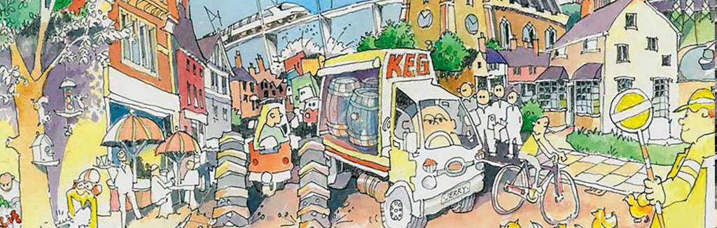
Harlow Bros Ltd
This is a family run timer merchants started here in the 1920s by brothers Reg and Vernon Harlow. They started in this location making small sheds and chicken sheds. The business prospered and in the 1930s they employed some 30 staff, mainly from the village, and designed and manufactured poultry houses, greenhouses, sheds and garages, and then prefabricated wooden bungalows. In the 1940s during World War 2 they manufactured air raid shelters and ladders for the fire service. The company continued to prosper and expand, and now have a further 10 other branches throughout the midlands.
Harrison House
A free school was founded in this Elizabethan timber framed house in 1575. It was later extended in 1675. At the turn of the 18th century it was inhabited by John Heathcoat who invented an industrial lace machine, and whose work amongst others spelt the end of the cottage framework industry and led to the Luddite Riots.
Hathern
A settlement probably existed here in the Saxon period, but the first written record was in the Domesday Book where it was called Avederne, Old English for hawthorne. The current name Hathern is also probably derived from the same origin. Prominent in the centre of the village is Hathern cross, dating from the 14th century. Like most villages in this part of the country, farming and framework knitting were major sources of employment. A notable former resident was John Heathcoat (1783–1861), inventor and industrialist, who operated a textile mill in Hathern (where, in 1808–9, he invented the bobbin net machine, for weaving a lace-like hexagonal net), before moving his business first to Loughborough, and later to Tiverton, Devon. The village is still home to the Swift Sock Factory, one of only a small number of independent sock manufacturers left in the UK. The Framework Knitting machine in Kegworth Heritage Centre originated from the Swift factory.
The Hermitage
The Hermitage has an interesting and varied past. There have been many dwellings on the site including a nunnery in the 15th Century, then it was subsequently used in the 16th Century a religious retreat for Church dignitaries who were travelling between Newstead Abbey in Nottinghamshire and Leicestershire, from whence it derived its name.
It was owned by the family of Catherine Parr (Henry VIII’s sixth wife) who used it as a hunting lodge, and although Catherine Parr never lived here, she would have certainly visited. In more recent times Dr Bedford and his son lived in The Hermitage and were successively the village doctors from 1876 until the NHS was founded in 1948. With the advent of the NHS he felt he was too old to change and retired, ceremonially cutting the wires to his telephone. The latter Dr Bedford died in 1968, bequeathing the house to Mrs Ridley-Thompson who then lived there until the house was sold in 2021. Parts of the building date back to Tudor times, with many alterations and extensions carried out in the early reign of Queen Victoria, and then later additions made in the 1920s. There are tales there was once a tunnel running between St. Andrews Church and The Hermitage, although there is no evidence for this. It is also reputedly haunted, by a ghost of shrouded figure seen on numerous occasions. The was a case reported of a workman who fled the cellar having encountered a lady in white, though the then owner, Dr Bedford, assured him she was friendly, having lived with her for several years.
Kegworth Bridge
There has been a bridge across the River Soar at this point from around 1315. A later bridge was demolished in 1785 and replaced by the current bridge, built using sandstone from Bunny Hall, although at that point it was built only 12ft wide. The bridge was widened sympathetically in the same stone-built style to 40ft wide in 1937. There are 5 main semi-circular arches for the spanning across the River Soar, with the river itself running under arches 1, 2 and 3. The bridge then extends further with the canal cut passing under an additional single 6th arch. The canal cut and bridge extension was built in 1825. This was done to avoid the many accidents as barges tried to take the tight river bend and then navigate the bridge arches without hitting the supports. It is possible to walk under arches 4 and 5, and you can see the stonework evidence of the bridge widening. The widened bridge was formally opened in 1937 by the Duchess of Norfolk, daughter of Lord Belper.
Kegworth Carnival
The carnival started in 1928 as a village fete run by the Kegworth Hospital Association and included a fancy dress parade marching through the village headed by the Kegworth Band. This developed into a “Grand Parade” of decorated floats which made its way through the village down to Hallstone Meadow. The final carnival was in 1939 due to the outbreak of WW2. The Carnival was resurrected by a village committee in 1950 and was an immediate success. Running in July, it grew from strength to strength and became nationally renowned, attracting tens of thousands of visitors with a traction engine rally, horticultural show, ox roasting, entertainment shows and traditional parades through the village with a Carnival Queen. The Carnival was always held on the last Saturday in July but in 1962 it became a 2-day event. The last Carnival was in held on 29 and 30 July, 1989, after which the Meadow was no longer available.
Kegworth Community Library
Kegworth Library has been a Community Library since 2016 which means that it is run by volunteers and is self-funding. More than just a library, they aim to be a community hub providing a meeting space for many groups including craft groups, singing and bingo. They offer services such as venue hire, printing, a book shop, sale of cards and stamps, a jigsaw library and, very importantly, offer tea and coffee and comfy chairs.
Kegworth Heritage Centre
Having originally opened in 1992 as Kegworth Museum in a converted farm building, Kegworth Heritage Centre has recently reopened in a revamped format, following a forced period of closure due to necessary and widescale building repairs and refurbishments.
With new displays including local and historical artefacts, photographs and information, including the Robert Williams collection of Roman items, Kegworth Heritage Centre is a place to visit and learn about village life and how people lived, worked and played in Kegworth days gone by.
Midshires Way
Midshires Way is a 225 mile long distance footpath and bridleway which runs through middle England, connecting the Ridgeway Path south of Aylesbury with the Pennine Way and Trans Pennine Trail at Whaley Bridge in the Peak District.
The Mill
To the right where the Osiers housing development now stands, this was once the site of The Mill. According to the Doomsday Book there had been a mill here before the 9th century. In 1790 the mill wheel operated an iron forge eventually reverting to grinding corn again in 1812. In 1870 the mill was bought to grind local gypsum and was called Winsers Plasterboard Mill. This closed in 1904. Since that date until the 1950’s, the site was used for a basket making industry using canes from the osiers growing in the area – giving the housing development there its name.
Thomas Moore
Thomas Moore, the Irish poet was born in Dublin in 1779 and came to live in Kegworth during 1812-13. The main reason for staying here was to be near his friend and benefactor, Lord Moira of Donington Hall.
New Brickyard Lane
Bricks were much sought after for building during the industrial revolution and Kegworth bricks were made at the clay pit on the right at the top of this lane, where the houses are now located. There were several traditional brick kilns for firing the bricks made of the local clay, and many houses in Kegworth during the 18th and 19th centuries were constructed with these local bricks.
The Otter
The pub started out as The Navigation in the 1860s, and alongside the pub was a coal wharf. From 1953 to 1961, it was the headquarters of the Soar Boating Club. The pub changed its name from The White House to The Otter in 1997 when it re-opened after refurbishment.
Remembrance Way
The A453 was made into a dual carriageway in 2015 and was named Remembrance Way for the 435 military personnel who lost their lives in Afghanistan.
River Soar Navigation and Loughborough Canal
The River Soar was made navigable by boats between the River Trent and Loughborough by the Loughborough Navigation Company in 1778, and for a time the Loughborough Navigation was the most profitable waterway in Britain. The River Soar was made navigable in some parts by means of straight “canal cuts”, which formed short-cuts, as the name suggests, cutting off some of the more curvaceous parts of the river. This section here that you have crossed is the “Zouch Cut”.
The navigable boat route was extended to Leicester in 1794, and further to Market Harborough by 1809, now under the name of The Leicestershire & Northamptonshire Union Canal. Eventually, after a merger with The Grand Junction Canal company, it linked together to become part of the Grand Union Canal running all the way from the River Trent to London in 1814.
St Peter and St Paul Church, Hathern
Built of Charnwood stone, some parts of the structure date back to Saxon and Norman times, but the majority of the current church was built in then 14th Century, with later alterations in 1861-2. The tower contains a peel of 8 bells, and there is a Saxon font within the church which is one of the oldest in the country.
Saxon Earthworks
Adjacent to Hermitage, in the field to the left from your viewpoint is the site of the ancient Saxon village of Popesthorpe.
Stockinger’s Workshop
The long line of glass windows on the first floor – used to facilitate a lot of light inside for working the knitting machines, can be seen from the road and this is a fine example of this type of cottage industry which made socks, stockings and gloves from the time of the industrial revolution to well into the 1960s.It is the only surviving obvious example of this type of workshop in Kegworth, but there were large numbers of such workshops in Kegworth and other villages throughout Leicestershire and Nottinghamshire. Records show that the workshops of Kegworth made hosiery for many crowned heads of Europe as well as making stockings for the weddings of both Queen Victoria and Queen Mary.
Tongues Island
To improve the navigation for canal barges around a difficult and sharp bend in the river known as Devil’s Elbow, a straight channel was dredged out in 1826, thereby creating an island. The island was used as agricultural land and in the early 20th Century it was devoid of the trees and bushes which now cover it. The island was farmed by a Sutton Bonington small holder. The straight channel was called Jimmy Gadd’s Cut after the constructor who made it.
Whatton Gardens
The renowned gardens of Whatton House are open to the public. Unaffected by the fire of 1876, the stable yard and the walled garden date from 1802, and many of the trees in the park and gardens are also over 200 years old. Although parts of the original 1802 gardens remain, much of what you see today was laid out in the late 19th century by the wife of the first Lord Crawshaw. She designed the 15 acres of mixed woodland and garden areas, with a myriad of trails leading through shaded trees and little dells. Some of the features include a courtyard café, a kitchen garden with several Victorian Glasshouses, a formal rose garden with views towards Charnwood forest, the “Bogey Hole” which is a former icehouse that was converted into a picturesque grotto with decorative rockery features, a Chinese garden with replica terracotta warriors standing guard, an Italianate decorative loggia with belvedere seating, a 19th-century summer house made of bark, an arboretum and a decorative pond created in the 1930s. The gardens can also be hired as a wedding venue.
Whatton House
The occupants of Whatton House have been the dominant landowners in the village, and it has been held by three families, the Dawsons, the Martins and the Brookes (Barons Crawshaw). The current late-Georgian mansion was built in 1802 for Edward Dawson by the architect John Johnson. In the early 1870s the Dawsons moved to Launde Abbey and It was bought by the First Lord Crawshaw. Only a short time later a disastrous fire struck, leading to the house being almost entirely rebuilt in 1876. The house was used as a maternity hospital in World War 2 and 2324 babies were born there, mostly to mothers who were evacuated from the bombing in London. During the war years several bombs were dropped in the area including 30 incendiary bombs that fell in the grounds on 10th Feb 1941. A nearby tied cottage was destroyed, killing a housekeeper. The house remains a private family home and is not open to the public, but the gardens are. The current occupants are the Fifth Lord Crawshaw and family.
Zouch Bridge, otherwise known as County Bridge
The original packhorse bridge, some 2 yards wide, was built in the early 14th Century at a point where there had been a ford, which was slightly to the south side of the present bridge. This was replaced by a new bridge in 1793 costing £700. This in turn was replaced by the present concrete bridge in 1931, which was built next to the old bridge on its north side, before the old one was then demolished.
In turn the current bridge has now been deemed to have suffered significant deterioration beyond repair and has had a max 18T weight limit placed on it. This bridge too is destined to be replaced by yet another new bridge, which will be built immediately to the south of the existing bridge – back where the original bridges used to be.
